San Marcos Elite Concrete works as a concrete contractor in Zuehl, on some of the most straightforward ground to excavate anywhere in this service area and some of the most constrained ground to build on. Those two statements are both true here, and which one applies to your project depends entirely on where the lot sits relative to a mapped flood line.
The digging is genuinely easy. About 99.96 percent of the place records no root-restricting layer at all within the profile to 200 centimeters: no lithic contact, no paralithic contact, no petrocalcic pan and no densic layer. Excavation here is limited by soil strength and moisture rather than by rock or hardpan, which is unusual in a region where refusal at a foot is common.
The constraint is water. About 30.73 percent of the place is inside a FEMA Special Flood Hazard Area, and the composition is what makes it unusual: regulatory floodway accounts for 24.16 percent of the place and Zone AE outside the floodway for only 6.57 percent. Floodway is the class carrying the tightest restriction on placing fill or structures, and here it is roughly a quarter of the place rather than a narrow band beside a channel.
Two Meters of Soil With Nothing to Refuse In It
What an Unrestricted Profile Lets You Do
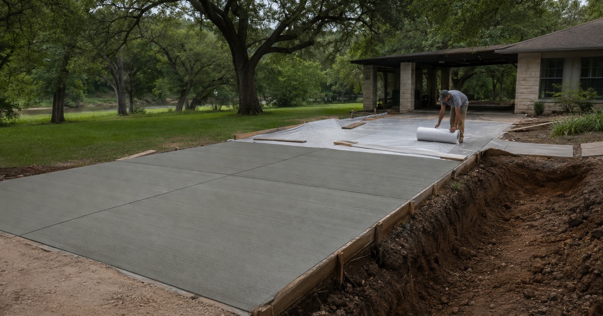
Where nothing refuses within two meters, footings, grade beams, piers and trenches can be taken to whatever depth the design calls for without a hammer, a rock bucket or a day lost to breaking material. Parent material explains it: 48.76 percent of the named components formed in calcareous clayey alluvium derived from mudstone, 20.44 percent in loamy Quaternary alluvium and 16.11 percent in calcareous clayey alluvium from Pleistocene mudstone.
That freedom is worth using rather than ignoring. Founding below the seasonally active layer is an option here that simply is not available on shallow limestone ground a few miles west, and on the parts of the place that do move it is the most effective single thing a design can do.
Lewisville, and Why Plasticity Index Alone Misleads
Lewisville silty clay covers 47.36 percent of the place across two slope classes. The dominant component is a fine-silty Udic Calciustoll carrying 46 percent clay, liquid limit 52 and plasticity index 29, but a linear extensibility of 7.5 percent, with saturated hydraulic conductivity of 0.91 micrometers per second, which is 0.129 inches per hour.
That is a moderate movement soil rather than a high one: high clay content, but extensibility well below the Vertisol band. A contractor reading the plasticity index alone would design for heave across nearly half this place and be wrong about it, which is why we work from the extensibility figure instead.
The Ground That Does Move, and the Ground That Barely Does
Branyon carries the movement here. Its Bkss horizon runs 53 percent clay at liquid limit 69, plasticity index 43 and linear extensibility 13 percent, and it covers 18.96 percent of the place across two slope classes.
At the other end, Bosque on the frequently flooded ground is a Cumulic Haplustoll at 23.5 percent clay, liquid limit 34, plasticity index 16 and linear extensibility of only 1.5 percent, draining about ten times faster than Lewisville. Roughly a fifth of the place behaves like Branyon and roughly half like Lewisville, so the design question is which of three soils your lot actually carries.
Mollisols, Vertisols and What That Split Means for a Slab
Across the polygon, soils of the Mollisol order cover 72.53 percent and Vertisols 23.68 percent, with Inceptisols at 1.40 percent. Lewisville, the dominant unit, is itself a Mollisol. Eighteen map units intersect the place and nine of them cover under one percent each.
Practically, that means most Zuehl slabs are designed for load, even support and drying shrinkage rather than for seasonal heave, and a minority are designed the other way. We check the mapped unit for the address before deciding which, because building the wrong one costs money in one direction and reliability in the other.
Looking for concrete-contractor closer to Cedar Creek? See Concrete-Contractor Services in Cedar Creek.
A Third of the Place Is Hazard Area, and Most of That Is Floodway
Why Floodway Is a Different Conversation
Zone AE and Zone A are hazard area classes where a slab is generally permittable with conditions. The regulatory floodway is the channel and adjacent land reserved to carry the flood itself, and it is where placing fill or structures faces the tightest restriction of all.
With floodway covering roughly a quarter of the place, this is not an edge case here. A project that would be a routine conversation on Zone AE ground can be a considerably harder one a short distance away, and it is far better to establish that before a design exists than after.
Flatwork Is Development by the County’s Own Definition
The Guadalupe County Subdivision Regulations define development as all land modification activities, including the construction of buildings, streets, paved storage areas, parking lots, storm water management facilities and other impervious structures or surfaces.
A patio, a shed pad, a widened drive or a parking area is development under that wording. Placed inside the mapped hazard area, it falls under the Floodplain Development Permit the county requires through its Floodplain Administrator. The identical slab on Zone X ground, which covers 62.79 percent of the place, does not.
Reading Your Own Parcel Rather Than the Place
Percentages describe a polygon and not an address, and a further 6.48 percent of the place carries the 0.2 percent annual chance designation, which sits outside the Special Flood Hazard Area entirely.
That last distinction is a permitting one rather than a hydrological footnote, because the permit attaches to the hazard area rather than to the shaded band. We check the mapped classification for the specific parcel and say what it means for the work, the paperwork and the schedule before anything is committed.
Designing to Keep a Slab Out of Trouble
Where hazard area ground is involved, design choices matter more than usual. Keeping a slab at existing grade rather than building it up, avoiding fill, and reducing the footprint or moving it away from the channel are all things that can be decided on paper.
Cibolo Creek runs through the place across ten mapped segments, as does Santa Clara Creek, and because of Cibolo Creek this place falls within the San Antonio River Authority in addition to the Guadalupe-Blanco River Authority. Knowing which watercourse governs a parcel is part of getting the answer right.
Permits Here Come From the County, Not a City
No City, and No Residential Building Permit
Zuehl is an unincorporated Census Designated Place with no municipal government, no city hall and no city building department. There is no county building permit for detached residential flatwork either.
The Fire Marshal’s permit scope reaches new commercial and public buildings, remodels for a new type of business, business occupancy and multi-family of five or more units. A residential patio, carport pad, storage-building pad or set of steps behind the right-of-way line appears in none of those categories, and the county operates no residential building-inspection department.
An Interstate on the Boundary and No State Road Inside
There is no TxDOT on-system roadway inside the place, yet Interstate 10 runs along its boundary at three or four hundredths of a mile, as does FM 2538. FM 465 lies 1.64 miles off, FM 775 1.87 miles and FM 1518 2.01 miles.
So the place fronts an interstate while containing none of it, and a driveway apron on an interior street is a Guadalupe County Road & Bridge permit rather than a TxDOT one. Where a property connects to a state-maintained road instead, the state’s requirements apply, and we establish which before drawing anything.
County Standards and Where Their Authority Stops
Driveway permits are reviewed against AASHTO design controls and criteria. Minimum private driveway width is 15 feet and commercial 20 feet, and driveways extend from the paved portion of the public road to the owner’s property.
The county defines a driveway as an access constructed within a public right-of-way, and that is where its authority ends. The portion of your drive on private land falls outside that definition and outside the permit, which means the standard applied to it is whatever your contractor commits to in writing.
Building Where Nobody Is Checking
What We Write Down Instead of an Inspection
With no residential inspection, the record of what went under your concrete is the one we choose to make. We photograph subgrade, base and steel before every pour and hand over the file, and we give you the delivery ticket for each load.
That ticket carries the machine stamped batch time and date, the weights of cement, fly ash, sand and aggregates and the admixture names and quantities, and an incomplete ticket is grounds to reject the load at the curb. On a new build, that documentation is what a future buyer, insurer or engineer can actually rely on.
New Construction Rather Than Replacement
Most of what we do here is new work rather than repair, which changes the sequence more than the standards. Slabs, drives, patios and pads are being placed against a house that is also being built, so the order of trades, the timing of the approach and the protection of finished concrete all have to be planned.
We set out the sequence and the dates with the other trades rather than turning up to whatever is ready, and we protect finished flatwork from the traffic that follows it. A driveway poured too early in a build and then used as a lay-down area is the most common avoidable damage we see on new construction.
Small Places, Wide Margins, and Site-Specific Answers
Zuehl is a very small place, and every published figure about a small place carries a proportionally wide margin. We use the mapped soil and flood data because it is measured rather than assumed, and we treat it as a starting point rather than a verdict.
What settles a design is the site visit: what is actually exposed, what the drainage does in a heavy rain, whether there is fill from an earlier build, and where the water leaves the roof. Mapped data narrows the question and the lot answers it, and on a place this size that distinction matters more than it does anywhere larger.
- 20+ Years in Business
- Insured
- Free Written Estimates