San Marcos Elite Concrete works as a concrete contractor in Garden Ridge, where the most consequential fact about a job is often which side of a mapped line your lot sits on. A grid sample of 119,137 points inside the city polygon put 44.6 percent in the Edwards Aquifer Transition Zone, 34.6 percent in the Recharge Zone and 20.8 percent in the Contributing Zone within the Transition Zone.
Three zones, one small city, and none of them covering it. The three shares sum to 100 percent, which means every parcel here is inside a TCEQ-regulated zone of some description, and which one determines whether construction needs an approved plan before it starts.
A single point tells you nothing useful about this. Querying the city’s own center returns only the contributing zone classification and would miss both the recharge zone third and the transition zone plurality entirely. Twenty years on this corridor has taught us to check the parcel, and Garden Ridge is the clearest example of why that matters.
Why the Answer Changes Across One Small City
The Recharge Zone Third and the Plan It Requires
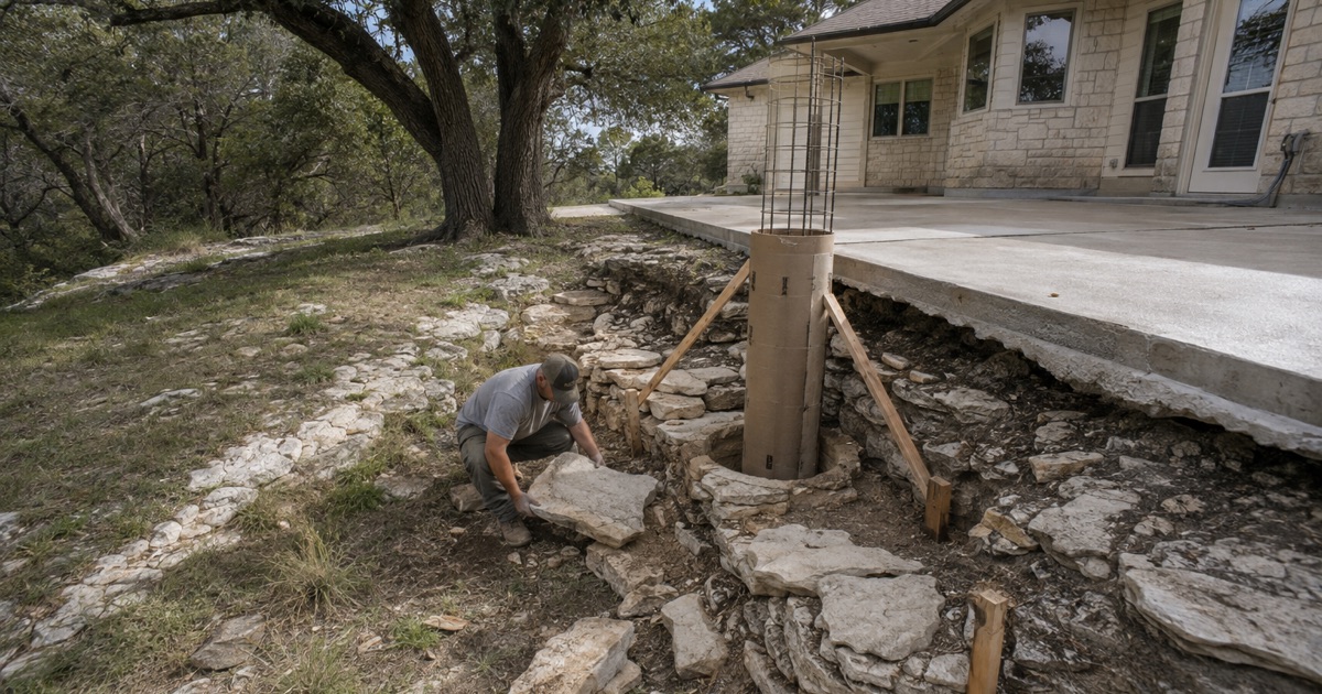
On recharge zone ground, all regulated activities under 30 TAC 213.3(28) require an approved Water Pollution Abatement Plan before construction, unless exempt under 30 TAC 213.5(h), and there is no acreage floor on that requirement.
No acreage floor is the part that surprises people. A large commercial development and a modest residential project are treated the same way by that rule, so the question is not how big the work is but whether it is a regulated activity on recharge zone ground. We establish that before pricing, because the approval sits ahead of the work rather than alongside it.
The Transition Zone, and the Drainage Question That Overrides It
Transition zone ground behaves differently on its own, but there is a rule that reaches across the boundary. A regulated activity on a site partly on the recharge zone and partly on the transition zone, where natural drainage flows back to the recharge zone, is treated as if the entire site were on the recharge zone and needs an abatement plan.
In a city that is 34.6 percent recharge zone with the rest interleaved around it, that drainage question decides the permit for a considerable number of parcels. It also means the answer is not simply which zone the majority of your lot falls in, but where the water from it goes.
How to Find Out Which Zone Your Lot Is Actually In
The zone status of a Garden Ridge job is a parcel question rather than a city question, and it is answerable. TCEQ publishes the zone geometry, and the legally official maps are scanned quadrangle sheets that the digital polygons represent rather than replace.
We check the specific parcel against the mapped zones, look at where natural drainage from the site goes, and tell you which of the three situations you are in before anything is committed. That answer changes the schedule more than it changes the concrete, which is exactly why it belongs at the start.
Impervious Cover and What Added Paving Does
Every patio, drive extension, pad and walk adds impervious cover, and on Edwards Aquifer ground that is the measure the rules are written around. It is also frequently the number that decides whether a project stays inside an exemption or falls outside one.
We calculate the added area against your site before the pour and tell you where it lands, rather than pouring first and dealing with it later. Where an exemption or a recorded limit is close, there is usually a design that gets you what you want and stays inside it, and that conversation is worth having on paper.
Looking for concrete-contractor closer to Cibolo? See Concrete-Contractor in Cibolo.
Rock on Two Fifths of the City, Clay on Pockets of It
Comfort, Real and Rumple at Thirteen to Fourteen Inches
This is shallow soil over limestone with clay pockets rather than one condition or the other. Comfort-Rock outcrop complex on 1 to 8 percent slopes covers 32.81 percent of the city, Real gravelly loam on 1 to 8 percent slopes 14.72 percent and Rumple-Comfort rubbly association 10.34 percent.
The shallow half is genuinely shallow. Comfort has a lithic bedrock contact at 33 centimeters, Real a paralithic contact at 36, Eckrant a lithic contact at 30 and Rumple a lithic contact at 71. Rock outcrop is a named component of the largest map unit in the city at 15 percent, and about 44.1 percent of the polygon has a root-restricting layer within 50 centimeters.
The Clay Pockets, and Why They Are Not a Rounding Error
The clay here is bounded but it is the high-movement kind. Heiden clay on 1 to 3 percent slopes covers 5.46 percent of the city and its major component carries 54 percent clay, plasticity index 45, liquid limit 70 and linear extensibility of 12.2 percent.
Krum clay on 1 to 3 percent slopes adds 4.22 percent at linear extensibility 10.3 percent with no root restriction at all, and Medlin in the Medlin-Eckrant association covering 5.45 percent measures 10 percent. Those parcels want a design built for movement rather than for rock, and it is the opposite of what the majority of the city needs.
Two Conditions on Adjacent Lots
The two situations sit next door to each other. Krum clay has no restricting layer and linear extensibility of 10.3 percent, while Comfort has bedrock at 33 centimeters and linear extensibility of 3.2 percent despite carrying 65 percent representative clay.
That last pairing is worth dwelling on, because clay percentage is not a usable proxy for movement here. A citywide statement about either subgrade movement or rock excavation will be wrong on a large minority of jobs, which is why we look at the mapped unit under your address rather than applying an average.
Excavated Ground and What It Does Not Tell You
About 7.12 percent of the city polygon is mapped as pits, the survey’s designation for excavated ground such as a quarry. Its only recorded properties are a liquid limit of 7 and a linear extensibility of 1.5 percent, with no clay content, no taxonomic order and no restriction depth.
That is what a disturbed map unit looks like in the survey, and it is a reminder that a soil map describes what was there rather than what somebody has since done to it. On any parcel that has been cut, filled or quarried, we investigate on site rather than trusting the mapping, because fill is what settles later.
Building on Rock Without Over-Building the Slab
Excavation Is the Line That Moves
Where trenching and footing excavation meets rock inside fourteen inches, the excavation line rather than the concrete line is what carries the price. Paralithic material can generally be ripped; indurated rock usually means a hammer, and the difference is measured in days rather than hours.
We price rock as rock, name which kind we expect, and say what happens if the ground turns out harder rather than leaving it open. On this ground a bid with no rock provision has either not been thought about or is planning to raise it when you have fewer options.
Base and Bedding on an Irregular Rock Surface
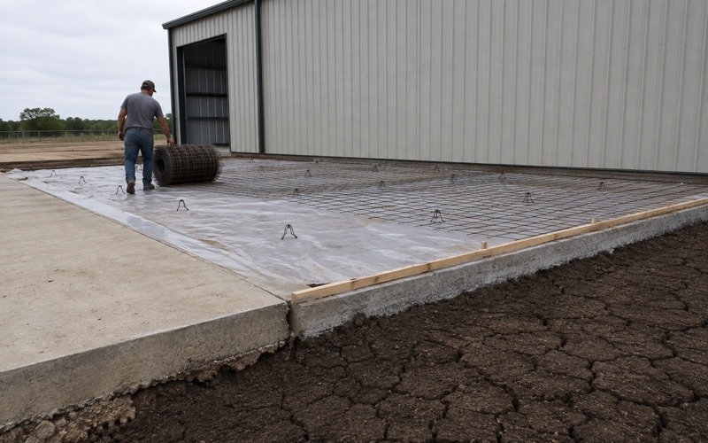
Excavating to rock leaves highs and pockets rather than a plane, and a slab poured onto that spans hollows and cracks where it bridges. The base course is what fixes it: bringing the surface to a uniform compacted plane and filling pockets with material that will not consolidate.
We measure compaction against proctor density rather than judging it by foot. On a slab that is otherwise well supported by rock, one settling pocket produces exactly the crack the base was there to prevent, and it is the failure most often blamed on the concrete.
Joints, Reinforcing and Getting the Design the Right Way Round
Where the ground barely moves, joint spacing is a drying shrinkage question rather than a soil one, and the slab is sized for load and for even support rather than for heave. Where a clay pocket governs, the design inverts and thickness, reinforcing and joint spacing all answer to movement.
Getting that the right way round on the specific parcel is most of the engineering value in a Garden Ridge quote. We cut control joints to the published schedule, chair steel at mid-depth rather than pulling a mat up through wet concrete, and set the panel geometry inside a one and a half to one aspect ratio in either case.
Who Actually Approves the Work Here
An Incorporated City With Its Own Inspector
Garden Ridge is an incorporated city with its own building inspector, and its building regulation sits in its own ordinances rather than in Comal County’s. That matters because the county regime immediately outside the city limits is genuinely different and does not reach inside them.
Outside the city, Comal County issues its own permits including a driveway permit through the county engineer’s office, which requires a pre-pour inspection with the right-of-way inspector for a concrete driveway. Inside the city, the city’s permits govern. We confirm which applies to your address rather than assuming from the postal town.
Recorded Covenants Are Often the Binding Design Authority
Every housing unit in the city is single-family detached and 95.6 percent of occupied units are owner-occupied, so there is no multifamily stock and effectively no landlord layer. The person deciding on a residential job here is the resident owner.
In that setting, recorded covenants and an architectural control committee are frequently the binding design authority on finish, color and how much of a lot may be paved, more so than any code provision. We ask for the current guidelines as well as the recorded declaration before drawings, because approval sought late is the most common reason a decorative job sits unpoured.
What We Put in Writing Either Way
Whatever combination of approvals applies, the quote names the mix, the reinforcing, the joint schedule and the base underneath, and we photograph subgrade, base and steel before the pour. Those four decisions are what a slab actually stands on, and a bid that leaves them unstated cannot be compared against anything.
You also get the delivery ticket for every load, carrying the machine stamped batch time and date, the weights of cement, fly ash, sand and aggregates and the admixture names and quantities. On ground this variable, a record of what actually went in under a specific slab is worth considerably more than a general assurance about how the company works.
- 20+ Years in Business
- Insured
- Free Written Estimates